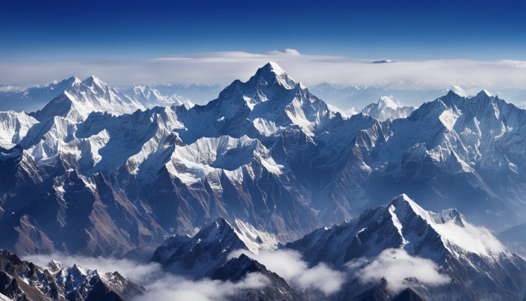
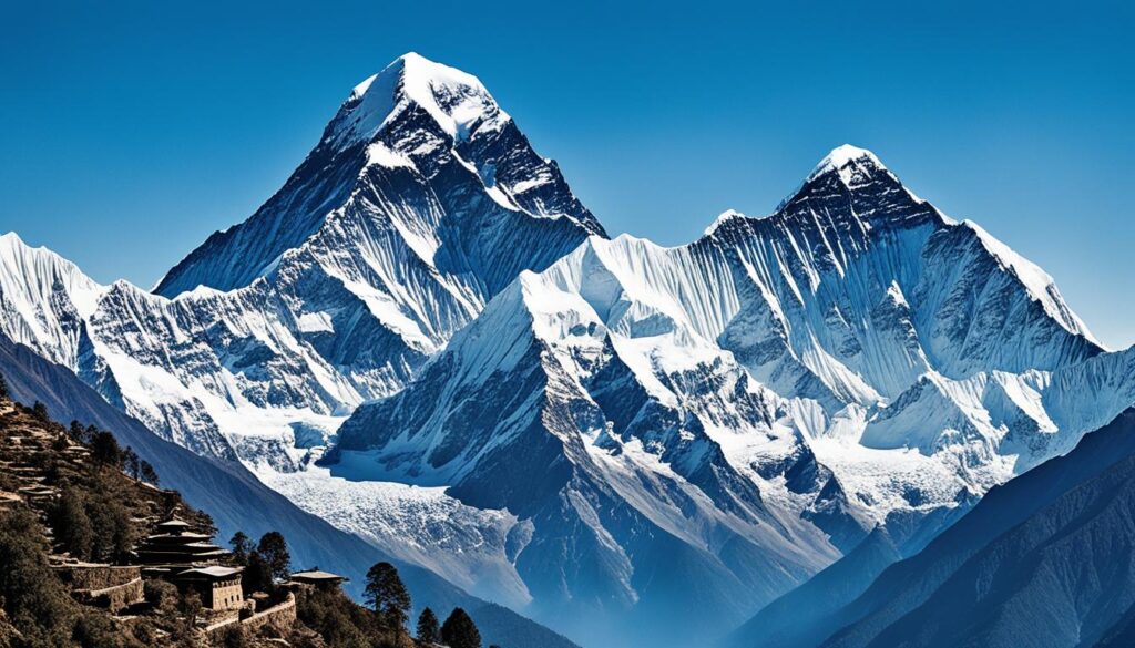
Mount Everest stands at a mighty 29,032 feet (8,849 meters) high. It is the tallest spot on Earth. It’s located on the border of Nepal and the Tibet Autonomous Region of China. This makes it not just a giant peak but a symbol of Earth’s extremes.
Mount Everest is always on the move. It shifts a bit to the northeast and gets taller each year. This shows Earth is always changing. This mountain is surrounded by vast glaciers like Kangshung and Khumbu. Knowing its coordinates, 27°59′ N 86°56′ E, shows how its big and special place in our world.
The cold around Everest can drop to a chilling −76 °F (−60 °C). Yet, people have reached the top as a big challenge. Edmund Hillary and Tenzing Norgay did so on 29 May 1953. But many have also lost their lives, with 340 deaths by May 2024.
Key Takeaways
- Mount Everest’s elevation reaches 29,032 feet (8,849 meters), confirming its status as the highest mountain globally.
- The Everest geographic position sees a natural shift to the northeast annually, showcasing Earth’s tectonic dynamics.
- Everest’s map coordinates are a practical guide for climbers, but also signify the mountain’s vast cultural resonance, especially in Nepal and Tibet.
- Glaciers covering Everest’s slopes and the mountain’s “three-faced pyramid” shape contribute to its unique topography and the challenges it presents to climbers.
- The best times to visit Everest Base Camp are April to October in Tibet, and September to November in Nepal, each offering different climatic conditions and experiences.
- Mount Everest continues to be a place of awe and reverence, suffused with the cultural significances given by the local names Sagarmatha and Chomolungma.
- The mountain’s location and elevation were officially established by Chinese and Nepali authorities in 2020.
Enigmatic Majesty: Understanding Mount Everest’s Location
Mount Everest is the tallest peak on Earth. It sits on the border of Nepal and Tibet. This area is full of the geographic features of the Himalayas. The Everest map coordinates are at 27.9881° N latitude and 86.9250° E longitude. They are key points on the big canvas of the Himalayas.
The Geographical Coordinates of Mount Everest
Mount Everest isn’t just a point on a map. It’s a high spot that touches the sky at 29,032 feet (8,849 meters). This mountain is special for its height and for showing earth’s geology. The coordinates help us find Everest on a map. They are important for both finding our way and showing its meaning.
Bordering Nations: Nepal and Tibet
The border between Nepal and Tibet is more than lines on a map. It’s where their cultures and nature meet. This area, with the great Himalayas and its hidden gems, is a sign of Everest’s grandeur.
People from Nepal and Tibet cherish Everest. They call it Sagarmatha and Chomolungma. For them, Everest is a sign of natural beauty and a holy place. It brings them closer to their faith.
This strong tie to Everest is also seen in those who climb it. They study the Everest map coordinates closely. Climbers face not only tough landscapes but cultural and environmental challenges too.
To wrap up, Mount Everest’s location on the Nepal-Tibet border is more than a point on a map. It’s a place full of human stories and earth’s history. Everest is a lasting symbol of our connection to nature and to each other.
Mount Everest on the World Stage
Mount Everest is not just any mountain. It is the highest one in the world. Standing proudly in the Himalayas, it’s a symbol of beauty. It shows the power of nature and culture on our planet.
The Continental Plateau: Asia’s Pride
Everest is part of the mighty Himalayas. The mountain range itself is a sign of nature’s majesty. Being on a big piece of land, it shapes the weather and land around it. This peak shows the amazing work of nature over thousands of years.
Global Recognition: The World’s Highest Peak
People from all over visit Everest. It’s famous not just for being tall. It’s a place where brave people test their limits. It’s an iconic spot for anyone interested in exploring, science, or stories of adventure.
Everest’s summit reaches up to 29,032 feet. It is made up of rocks that have taken millions of years to form. This shows the everlasting changes happening on our planet.
Now, let’s look closer at Everest in the Himalayas:
| Feature | Description | Elevation |
|---|---|---|
| Mount Everest | Located on the Nepal-Tibet border, known locally as Sagarmatha (Nepal) and Chomolungma (Tibet). | 29,032 ft (8,849 m) |
| Surrounding Peaks | Includes Lhotse, Nuptse, Changtse among others, forming a stunning panorama. | Over 7,900 ft (2,400 m) each |
| Local Impact | Significant cultural and spiritual site, revered as “Mother of the World.” | Cultural elevation: Immeasurable |
Everest is more than its height. It’s a symbol of influence over the land, people, and stories around it. Its impact is lasting and meaningful.
Decoding the Topography: Everest’s Position in the Himalayas
The Everest geographic position is at the heart of the Himalayas. It shows the region’s high point and its changing land over millions of years. Mount Everest stands tall because of the Earth’s plates coming together. This has shaped the chest of the world. Here, you see rugged lands and high peaks. These are spots explorers often choose to see and study.
The trekking routes to Everest bring adventure and tough tests. Walkers meet all kinds of land, from green places to ice. These trails connect the world. They are not just for climbing. They show how everything here is linked together.
| Feature | Description |
|---|---|
| North Face | The stern face that presents some of the most perilous climbing conditions. |
| Southwest Face | Known for its more accessible climbing routes, popularized by historic summits. |
| East Face (Kangshung Face) | Offers a secluded and less traversed route due to its remote positioning and difficult access. |
Mount Everest stands out because of its surrounding giants. Peaks like Lhotse, Nuptse, and Changtse highlight Everest’s fame. They share its tough weather and brave spirit. Together, they tell a full story of this amazing place.
Maps and Modes: Representing Everest’s Geographic Position
Mapping Mount Everest changed from model making to digital advances. This makes it easier for people to see and understand Everest’s features.
Scale Modeling: Cartographic Representations of Everest
In the past, experts made models to show Everest’s position. These models gave us a 3D look at the mountain. Now, digital tech adds detailed data and live weather to this view.
Digital Age Mapping: GPS and Satellite Imagery
Today, GPS and satellite images improve Everest’s map details. These maps show not just the land, but also weather and safe paths. It helps climbers with important travel choices, which lowers risks.
One amazing app is RealityMaps. It uses 3D images to help both experts and fans. It shows the mountain’s true look and helps plan climbs.
| Feature | Traditional Scale Modeling | Digital Age Mapping |
|---|---|---|
| Detail | Generalized topography | Precise elevation data with Everest geographic position |
| Interactivity | Static models | Interactive GPS tracking |
| Utility | Limited updates | Real-time environmental updates |
| Scope | Physical display | Global accessibility |
From simple models to high-tech mapping, Everest’s view has greatly improved. Now, climbers have better tools and understand Everest more. This is big for both tech and how we see Everest.
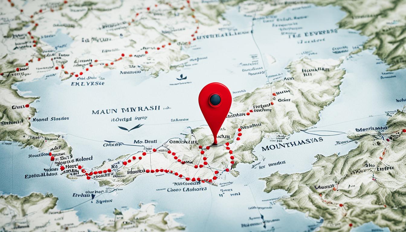
Where Is Mount Everest Located On a Map
Knowing Everest Base Camp location and trekking routes to Everest is key for adventurers. Maps clearly show these paths and points of interest along the way. They are very helpful for people climbing or trekking in the Himalayas.
The Practicality of Trekking Maps for Aspiring Climbers
Trekking maps are vital for reaching Mount Everest’s peak. They include distances, altitudes, and how long each trek takes. They also help plan where to stop for acclimatization and where to be careful of natural dangers.
Everest Base Camp Location Known Through Maps
The starting point for Everest climbers is the base camp, well-marked on maps. It’s where climbers prep for tough parts of the climb, like the Khumbu Icefall. This spot is crucial in getting ready for the journey to the top.
When talking about where Mount Everest is on a map, we must look at the maps. They show Everest’s surroundings, including parts like Lhotse, Nuptse, and the Everest Base Camp location. This helps climbers know the whole area better.
| Feature | Description | Importance in Trek |
|---|---|---|
| Khumbu Icefall | A mass of glacial ice that moves, it’s known for danger and beauty. | One of the biggest challenges right after the base camp. |
| South Col | A sharp gap joining Lhotse Face and Everest top. | Key path to Everest’s top, usually the last camp before the final push. |
| Lhotse Face | A steep ice slope next to Mount Everest. | Must climb it to reach higher camps on the Southeast Ridge. |
Seeing where Mount Everest is on a map helps climbers a lot. It gets them ready, not just physically, but also mentally. Each map is like a guide and inspiration for those who seek to conquer Mount Everest.
The Cultural Importance of Everest’s Location
Mount Everest is part of the big Himalayan range. It’s not just a spot on the map. It means a lot to people in Nepal and Tibet. The Sherpas and others see Everest as part of their spiritual life.
They use Everest in their everyday and spiritual rituals. In Tibet, it’s called the “Goddess Mother of the World.” People look to it as a spiritual protector.
Mount Everest transcends geography to become a symbol of spiritual aspiration and reverence, deeply rooted in the hearts of those who live in its shadow.
Everest is very high up and affects the area a lot. Climbers from all over come to climb it. They learn about the local culture, making Everest’s story even richer.
| Cultural Aspect | Description |
|---|---|
| Spiritual Significance | Mt. Everest is seen as a deity in both Nepalese and Tibetan cultures. |
| Local Impact | The mountain influences local traditions, festivals, and daily life, promoting a unique way of life. |
| Global Interaction | Annual influx of climbers introduces global cultures to local customs, fostering a cultural exchange. |
The Himalayan mountain range mixes nature with human beliefs. This makes it a special place for both nature and spirit.
Realizing Everest’s cultural value makes us understand the locals. It’s more than a big mountain to them. It’s part of their culture and legacy. So, we should appreciate its spiritual place too.
Everest’s Neighbors: Peaks and Passes of the Himalayan Mountain Range
Mount Everest is just one part of the massive Himalayan mountain range. It stands tall in the Mahalangur Himal, which is dotted with the world’s highest peaks. These famous peaks are called the ‘Eight-Thousanders’ because they surpass 8,000 meters.
The Significance of the Mahalangur Himal Sub-Range
The Mahalangur Himal is like a natural fortress with peaks over 8,000 meters high. It’s a rugged, beautiful place that shows off the Himalayas’ extreme side. This area, home to Everest, also features Lhotse, Makalu, and Cho Oyu. These peaks aren’t just big; they are key to the area’s map and culture.
Identifying Everest Amidst the ‘Eight-Thousanders’
At 29,032 feet, Mount Everest is the tallest in the world. It stands with other great peaks in the Mahalangur Himal. Spotting Everest among these giants is done through old and new ways.
Here’s a quick look at Everest and its ‘Eight-Thousander’ neighbors:
| Peak | Elevation (Meters) | Popularly Known As |
|---|---|---|
| Mount Everest | 8,849 | World’s Highest Mountain |
| Lhotse | 8,516 | 4th Highest in the World |
| Makalu | 8,485 | 5th Highest in the World |
| Cho Oyu | 8,188 | 6th Highest in the World |
This list shows the main peaks of the Mahalangur Himal sub-range. It points out their shared landscape and importance. Together, these peaks affect the weather and life in the Everest area, making them key parts of Everest’s global high-altitude reputation.
Challenges in Charting: The Evolving Map of Everest
Mapping Mount Everest, the world’s highest peak, is a task complicated by both historical and ongoing geographic changes. To create accurate maps, we need to mix old surveys with new data. This tells the story of Earth’s changes over time.
Historical Surveys and Modern Adjustments
In the 19th century, the Great Trigonometrical Survey of India began charting Mount Everest. It was tough work because of the hard-to-reach places and technology limits. Nonetheless, they started a practice that helps us map Everest today. As time went on, more surveys and better maps by the Royal Geographic Society improved our understanding of the mountain.
The Impact of Tectonic Motion on Everest’s Map Coordinates
Map coordinates of Everest change due to plate tectonics. The movement of the Indian and Eurasian plates moves the mountain northeast 4 cm each year. This movement also changes Everest’s height. Cartographers must keep up with these changes to ensure accurate maps for everyone’s safety.
The work of mapping Everest shows nature’s ongoing transformation and human mapping skills in action. From old surveys to new updates, we see the story of Earth’s evolution. This process combines the daring missions of the past with today’s technology for a complete Everest map.
Mount Everest Climbing Routes on the Map
Mount Everest is massive, reaching 29,035 feet high. It calls to those seeking adventure. Every route has a story of human strength and nature’s beauty. These tales are all marked on detailed Everest map coordinates. Knowing these paths is key to reaching the summit.
Everest Map Coordinates Guiding Climbers
Anyone climbing Everest must learn its routes well using detailed maps. 3D RealityMaps GmbH helps with GPS to navigate the Khumbu’s tough terrain. This tech is crucial for safe climbing, especially in complex areas and harsh weather.
North vs. South: Comparative Pathways to the Peak
Choosing a route means deciding between Nepal’s South Col and Tibet’s Northeast Ridge. Each has its own tests and beauty. They require different skills and levels of readiness.
A direct comparison:
| Feature | South Col Route | Northeast Ridge Route |
|---|---|---|
| Base Camp Altitude | 17,500 feet (5,334 meters) | 17,500 feet (5,334 meters) |
| Key Challenge | Khumbu Icefall | Second Step ascent |
| Camp 2 Altitude | 21,000 feet (6,400 meters) | 25,590 feet (7,800 meters) |
| Summit Day Duration | 1 hour or less | 1 hour or less |
Both paths are historic, adding to Everest’s climbing lore. Understanding these routes is both practical and informative. Climbers honor Everest’s history and nature, whether on the South Col or Northeast Ridge. They write their part of Everest’s story with respect and bravery.
Conclusion
Mount Everest sits at 27°59′ N 86°56′ E. It is a wonder of nature’s grand design. This location shows the top of the Himalayan mountains. Its height is a record-making 29,032 feet (8,849 meters). Every year, it moves a tiny bit to the northeast and climbs a little higher. This is tracked by very accurate tools.
Finding Mount Everest on a map shows its huge size in the Mahalangur Himal region. This area has four of the world’s six highest peaks. The weather there is extreme. The snow, strong winds, and big changes in temperature make it a hard place to visit. At the very top, a line marks the border between China and Nepal.
Many people take trips to Everest every year. They start from Nepal and Tibet. These trips take 8 to 12 days. They show people’s desire to explore and connect with nature. Climbing Everest shows its importance as a spot for adventure. It attracts many who love the beauty of the Himalayas.
FAQ
Where exactly on a map is Mount Everest located?
Mount Everest is at 27°59′18″N, 86°55′31″E, on Nepal and Tibet’s border. It’s within the Himalayas.
How are Everest’s geographical coordinates significant?
Everest’s coordinates mark the world’s highest peak. They help in mapmaking, navigation, and expeditions. They also show Everest’s big importance globally.
What is the elevation of Mount Everest?
At 29,032 feet (8,849 meters), Mount Everest is the tallest mountain.
Which countries border Mount Everest?
Nepal is to the south, and Tibet, part of China, is to the north.
Are there trekking routes to Everest depicted on maps?
Yes, maps include trekking routes, like those to the Everest Base Camp. They’re key for climbing the summit.
How does technology help in mapping Mount Everest?
GPS and satellites help make detailed maps of Mount Everest. This aids climbers, scientists, and allows viewing from far away.
Where is the Everest Base Camp located?
Two base camps are at Everest. Nepal has the South Base Camp at 17,598 feet. Tibet’s North Base Camp is 16,900 feet.
Why is Everest called “Sagarmatha” and “Chomolungma”?
“Sagarmatha” means “Goddess of the Sky” in Nepali. “Chomolungma” means “Goddess Mother of Mountains” in Tibetan. These names show the locals’ strong respect for the peak.
What defines the Himalayan mountain range geographically?
The Himalayas stand out with their tall peaks and deep valleys. They formed from tectonic plate movements.
How do tectonic motions affect Everest’s map coordinates?
Earth’s tectonic movements can shift Everest’s position slightly. The peak can also grow taller. This means maps need to be updated regularly.
What are the major climbing routes to reach the summit of Mount Everest?
The main paths are the South Col Route from Nepal and the North Ridge Route from Tibet. Both have their challenges and history.


